










Signed for printing 30.03.2024

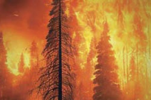
We present a slightly abridged and adapted translation of the report “A brief review of the effect of wildfires on rockfall occurrence” by Spanish specialists (Perez-Rey et al., 2023). This report was presented at the Regional Symposium of International Society for Rock Mechanics “Rock and Fracture Mechanics in Rock Engineering and Mining” (“Eurock 2022”) in Helsinki, Finland. It was also published as an article in the journal “Earth and Environmental Science” by the publishing company of the British scientific society “Institute of Physics” (IOP) that is now virtually international. It is an open access article under the CC BY 3.0 license that allows it to be distributed, translated, adapted, and supplemented, provided that the types of changes are noted and the original source is referred to. In our case, the full reference to the original paper (Perez-Rey et al., 2023) used for the presented translation is given in the end. Wildfires and rockfalls are among the major hazards in forested mountainous regions across Europe. Understanding processes and conditions that lead to rockfalls during and after a wildfire in different geological contexts is, therefore, of great relevance. The increase of rockfalls associated with the occurrence of wildfires is connected to several factors. Wildfires cause changes in the mechanical properties of rocks and discontinuities as well as the loss of protective capacity from vegetation, complemented by the effect induced by firefighting activities and by extreme temperatures that may deteriorate the installed protective measures. After the occurrence of a wildfire, there is an increase in the frequency and intensity of rockfalls in the burned area, causing a major impact of rockfalls on road networks and inhabited areas. Additionally, the rockfall risk perception is usually increased due to the removal of vegetation by wildfires, exposing both rock blocks and the rock mass. In this review, the main factors that influence the occurrence of rockfalls after a wildfire are briefly reviewed.
We present a slightly abridged and adapted translation of the report “Response analysis of the excavation of a deep foundation pit for a metro station in soft soils” by Chinese geotechnical engineers (Wu et al., 2019). This report was presented in 2019 at the International Conference on Advances in Civil Engineering, Energy Resources and Environment Engineering in Jilin (China). It was also published as an article in the journal “Earth and Environmental Science” by the publishing company of the British scientific society “Institute of Physics” (IOP) that is now virtually international. It is an open access article under the CC BY 3.0 license that allows it to be distributed, translated, adapted, and supplemented, provided that the types of changes are noted and the original source is referred to. In our case, the full reference to the original paper (Wu et al., 2019) used for the presented translation is given in the end. The whole process of the construction of a deep foundation pit for a subway station in Ningbo soft soil area was modeled using the PLAXIS finite element software on the basis of the HS (Hardening Soil) constitutive model. A comparative analysis of the obtained simulation results and field monitoring data was carried out. The analysis indicated that the numerical simulation results could be well fitted to the field monitoring data. It was proved that the PLAXIS model on the basis of the HS constitutive model could perform the numerical simulation analysis of complex foundation pit excavation in a soft soil area very well. According to the monitoring data and calculated values, the horizontal displacements of the retaining wall (diaphragm wall) and surface settlements, which were caused by the excavation of the auxiliary foundation pit, were small and had little effect on the main foundation pit. It was proved that the construction method of the foundation pit support system for the considered project could control the influence of the excavation of the auxiliary foundation pit on the main foundation pit very well.
In the first part of the series of articles, which are offered to the readers of the “Geoinfo” journal, the results of testing frozen soils in a resonant column were presented in detail. As an analysis of published data shows, studies of the dynamic properties of frozen soils is often carried out using the triaxial compression method. Its advantage, compared to testing in a resonant column, is the possibility of assessing the elastic-viscoplastic deformations of frozen soils. Testing by this method using low-frequency high-amplitude vibrations make it possible to evaluate the mechanical behavior of frozen soils (for example, under seismic influence). This article provides a literature review of the results of triaxial compression tests of frozen soils with an emphasis on temperature variations. The results of generalization of the dynamic properties of frozen soils show that at low negative temperatures ( –10 °C or lower) the deformation modulus is usually more than 4000 MPa, at temperatures from minus 3 °C to minus 5 °C it varies on average from 600 to 3000 MPa, at temperatures higher than minus 3 °C it decreases to 715–400 MPa, depending on the composition, properties of the tested soil and on the test conditions. The damping ratios of frozen soils (D) vary in a wide range (from 0.01 to 0.2 and higher), depending on the composition, humidity, temperature of the tested soil and on the test conditions). Most publications note increasing damping ratio values with increasing temperature of the tested frozen soil. This article also presents the results of measuring the pore pressure of soil, which have a temperature of minus 0.2 °C, during its dynamic loading.
We present a slightly abridged and adapted translation of the paper “Discrete element modeling of the effect of particle shape on creep behavior of rockfills” (Wang Yu. et al., 2017) by researchers from Tsinghua University (Beijing, China). This paper was published in the International Journal of Geological and Environmental Engineering. It is an open access article that is available on the website of the WASET publisher (World Academy of Science, Engineering and Technology) under the CC BY 4.0 license that allows it to be copied, distributed, translated, adapted, modified, mixed and used for any purposes (even commercial ones) provided that the types of changes are noted and the original source is referred to. In our case, the full reference to the original paper (Wang Yu. et al., 2017) is in the end. Rockfills are widely used in civil engineering, such as dams, railways, and airport foundations in mountain areas. A significant long-term post-construction settlement may affect the serviceability or even the safety of rockfill infrastructures. The creep behavior of rockfills is influenced by a number of factors, such as particle size, strength and shape, water condition and stress level. However, the effect of particle shape on rockfill creep still remains poorly understood, which deserves a careful investigation. Particle-based discrete element method (DEM) was used to simulate the creep behavior of rockfills under different boundary conditions. Both rounded and angular particles were considered in this numerical study in order to investigate the influence of particle shape. The preliminary results showed that angular particles experience more breakages and larger creep strains under one-dimensional compression than rounded ones. On the contrary, larger creep strains were observed in the rounded specimens in the direct shear test. The mechanism responsible for this difference is that the possibility of the existence of key particle in rounded particles is higher than that in angular ones. The above simulations demonstrated that the influence of particle shape on the creep behavior of rockfills could be simulated by DEM properly. The method of DEM simulation may facilitate our understanding of deformation properties of rockfill materials.
Today, engineering geology as a science and engineering-geological surveys as the practical application of this science are in stagnation and even in decline. This is evidenced by a number of events and facts that have observed over the past 30 years or a little longer. Is it possible to reverse the situation, to return an understanding of the primary importance of Engineering Geology in the economic development of the country to the relevant authorities, customers, and heads of construction universities? Of course, yes. And this must be done. Because otherwise, accidents at important critical facilities will occur more and more often, and the cost and construction time will be steadily increasing with simultaneously decreasing the reliability of buildings and structures. However, this is impossible without understanding how the things were before. In connection with the approaching centenary of Engineering Geology, we talked with Igor Vladislavovich Dudler who is one of the luminaries in this sphere and who was awarded by the Sergeev medal “For contribution to the development of Engineering Geology”. He told us about the history of Engineering Geology and put forward a number of proposals for necessary changes in our time in this sphere.
The modern challenges and prospects for the development of the Russian construction industry in the 21st century require adequate development of engineering surveys needed for justifying design solutions and providing construction projects with reliable survey information at all the stages of their life cycle. In this regard, it is necessary to develop the strategy and tactics of engineering surveys on the basis of the comprehensive (scientific- technical, human resourcing, logistical, financial, regulatory, and expertizing) support of them. The generalizations and recommendations presented in this article, as well as the authors’ proposals will help solve priority and long-term problems in the implementation of the engineering survey strategy in the Russian construction industry in the 21st century. This publication was prepared on the basis of the corresponding report made at the Forum of Russian Engineering Surveyors in 2023.
Geographers from Lomonosov Moscow State University have proved the effectiveness of using Doppler meters of water flow velocity in rivers. Such sort of devices are installed on a vessel or at the bottom of a water body. They send ultrasonic signals into the water and catch the sounds reflected from solid particles suspended in the water. Due to the Doppler effect, the velocity and direction of movement of the water with these particles are determined. In a short time, it is possible to aquire lots of data in an automated mode and to use them in hydrology, ecology, and construction. The obtained data surpass the results of traditional methods of measuring the velocity of water flow (for example, using hydrological current meters, the operation of which is based on a mechanical measurement method). In Russia, Doppler profilographs have been still a rarity. At the webinar “Doppler Technologies in Hydrology”, Vsevolod Moreido, the head of the Hydroinformatics Laboratory (Institute of Water Problems, Russian Academy of Sciences) and a senior researcher at the Laboratory of Soil Erosion and Riverbed Processes (Faculty of Geography, Lomonosov Moscow State University), told about using such kind of devices. This article tells about the essence of the Doppler effect, about the difference between the methods of installing a profilograph at the bottom of a water body and on a moving vessel, about manufacturers of acoustic Doppler profilographs, about their pros and cons and about actions in order to satisfying the demand for such measuring equipment produced by Russian manufacturers.
 наверх


 Поделиться

 Поделиться
 Скопировать ссылку










 Скопировать ссылку
  Vk
Vk  Telegram
  Viber
Viber  WhatsApp


 Оформить подписку